Map Of Europe After World War 1
Hey there, history buffs and the just plain curious! Ever look at a map of Europe and wonder, "Whoa, what happened here?" Well, buckle up, because we're taking a little trip back in time to a moment when Europe's map got a serious makeover. We're talking about the aftermath of World War I, a time when borders were redrawn like a kindergartener's ambitious crayon drawing. It's kinda like when you rearrange your furniture and suddenly your whole room feels different, right?
So, World War I, also known as the "Great War," was this massive, messy conflict that wrapped up in 1918. Imagine a huge brawl where everyone was exhausted and a bit bruised. When the dust finally settled, the big winners, mainly France, Britain, and the United States, got to decide how things would look going forward. And boy, did they decide!
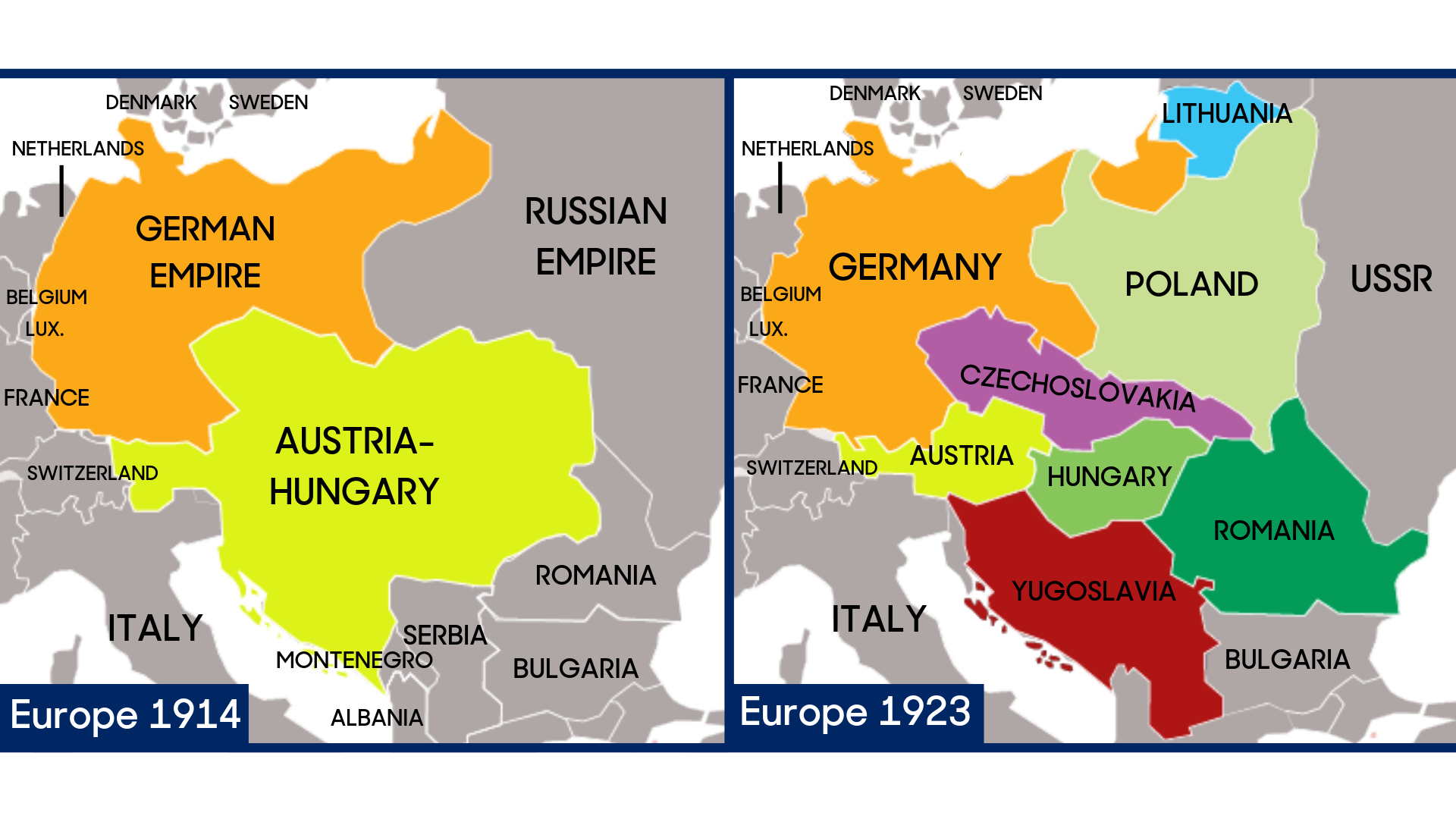
The biggest game-changer? The collapse of empires. We're talking about some seriously old and powerful players on the European stage. Think of them like the ancient, established families in a big city – they'd been around forever. But after the war, their reign was over. We're talking about the Austro-Hungarian Empire, the Ottoman Empire (which was partly in Europe), and the Russian Empire. Poof! Gone.
Must Read
This was a huge deal. For centuries, these empires had controlled vast swathes of land and a whole bunch of different peoples. Suddenly, those people, who often felt like they were just tiny cogs in a giant imperial machine, were looking around thinking, "Hey, maybe we could have our own thing!" It was like a group of friends finally breaking away from the overbearing leader of their club to start their own, more inclusive one.
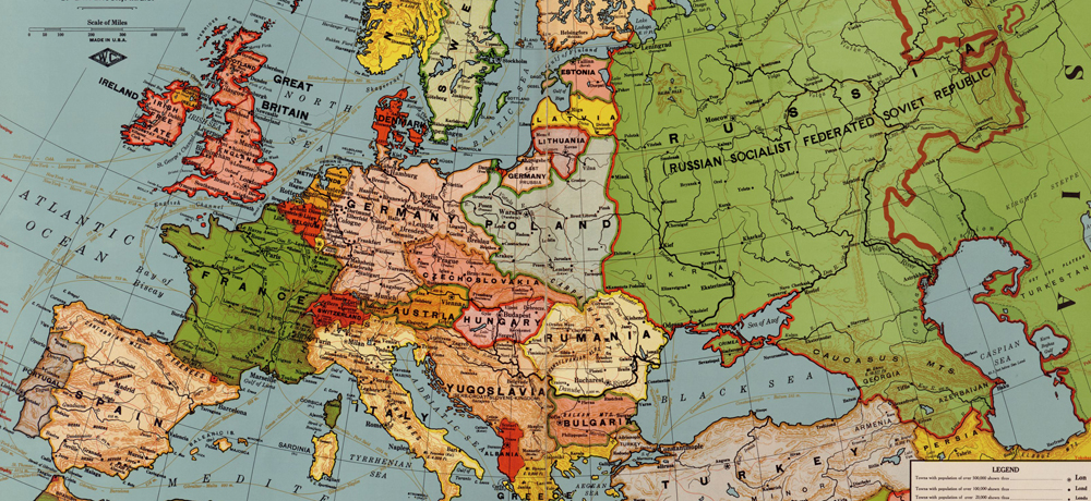
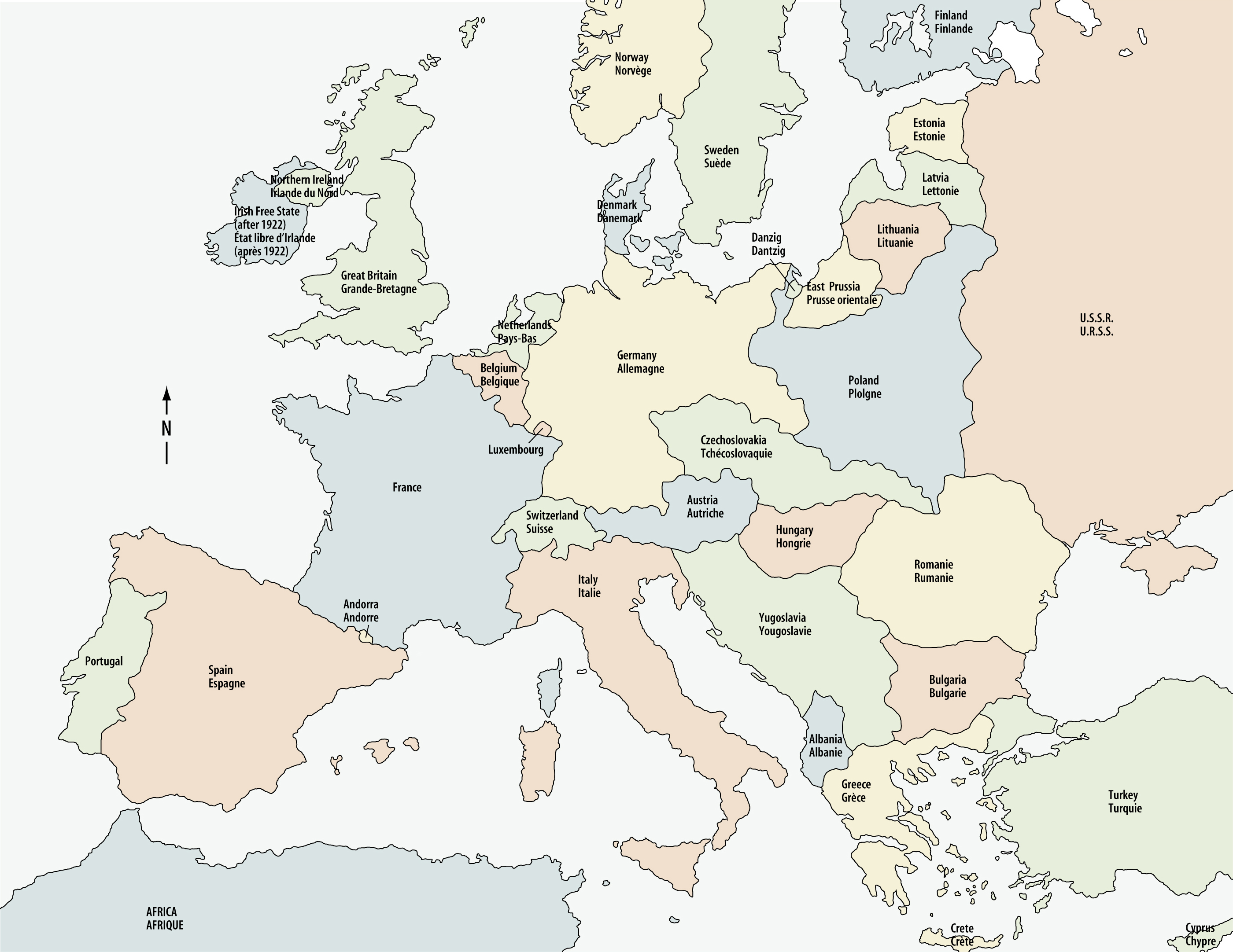
And so, out of the ashes of these fallen empires, a bunch of new countries started popping up on the map. It's like finding new little islands emerging from the ocean after a volcanic eruption! Countries like Poland, Czechoslovakia (which, spoiler alert, later split up into the Czech Republic and Slovakia – history is complicated, folks!), Yugoslavia (another one that eventually broke apart), Finland, Estonia, Latvia, and Lithuania were born, or reborn, or significantly reshaped.
Think about it: for people who had lived under foreign rule for generations, this was a moment of incredible hope and excitement. It was the chance to speak their own language freely, celebrate their own culture, and govern themselves. It was like finally getting to choose your own playlist after someone else has been controlling the music for years. Freedom, baby!
But, and there's always a "but" in history, right? Redrawing maps isn't as simple as sketching with a pencil. When you start chopping up territory, you inevitably run into tricky situations. What about the people who lived in mixed communities? What about the historical ties between different regions? It's like trying to divide a cake evenly – someone's always going to feel like they got a smaller slice, or that their favorite part (the frosting!) went to someone else.

One of the biggest challenges was creating these new nations while trying to keep as many people as possible within borders that matched their own ethnicity or nationality. This was the idea of self-determination, championed by leaders like Woodrow Wilson of the United States. The thought was: "If you're German, you should be in Germany. If you're Polish, you should be in Poland." Sounds neat and tidy, doesn't it?
However, Europe was (and still is!) a wonderfully diverse continent. Think of it as a really old, delicious stew with all sorts of different ingredients all mixed together. It wasn't always easy to separate the potatoes from the carrots. So, you ended up with significant minority populations in many of these new countries. For example, there were Germans living in newly formed Czechoslovakia, or Hungarians in Romania. This created its own set of tensions, and sadly, often led to discrimination and conflict down the line.
And then there were the victors, who also had their own agendas. France, in particular, wanted to make sure Germany could never threaten them again. So, they pushed for harsh terms and territorial changes that would weaken Germany. Think of it like the friends who won the game making sure the losing team had to wear silly hats for a week – a bit of a power trip, perhaps?

Germany itself was significantly shrunk. The Treaty of Versailles, the main peace treaty with Germany, took away territory like Alsace-Lorraine (which went back to France) and created the "Polish Corridor," a strip of land that gave Poland access to the sea but cut off East Prussia from the rest of Germany. Imagine someone building a fence right through your backyard – pretty annoying, right?
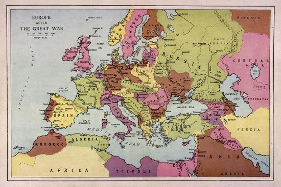
The map of Eastern Europe, especially, was almost unrecognizable compared to what it was before. Gone were the vast, sprawling empires. In their place, a patchwork of smaller, often struggling, nations. It was a bold experiment in nation-building, driven by the powerful ideal of national identity.

But here’s the really interesting thing: this new map wasn't exactly a recipe for lasting peace. While the idea of self-determination was noble, the practicalities were messy. The ethnic boundaries were often blurred, and the new states were frequently left with internal divisions and external grievances. It was like trying to build a brand-new house on shaky foundations.
These newly drawn borders, and the unresolved issues they created, would unfortunately sow the seeds for future conflicts. The simmering resentments over lost territory, the treatment of minority populations – these were all things that wouldn't just disappear. It's a stark reminder that even the best intentions can have unintended, and sometimes tragic, consequences.
So, next time you glance at a map of Europe, especially of Eastern and Central Europe, take a moment to appreciate the story behind those lines. They’re not just abstract borders; they represent the hopes, dreams, and sometimes the heartaches of millions of people. It’s a testament to how much a single event, like a world war, can fundamentally reshape the very landscape we live in. It's a history lesson etched in ink, a reminder that the world is always changing, and maps are just snapshots in time. Pretty cool, huh?